
Basic
ARS 45,000per month + VAT
- 3 users
- 50 km of fiber
- Extra user ARS 9,000

Software for fiber internet providers
Design, build, sell, bill and repair from one place. Your field crew works on the same network, even with no signal.
From ARS 45,000 per month + VAT
The problem
| TODAY | WITH ACRUX MAPS |
|---|---|
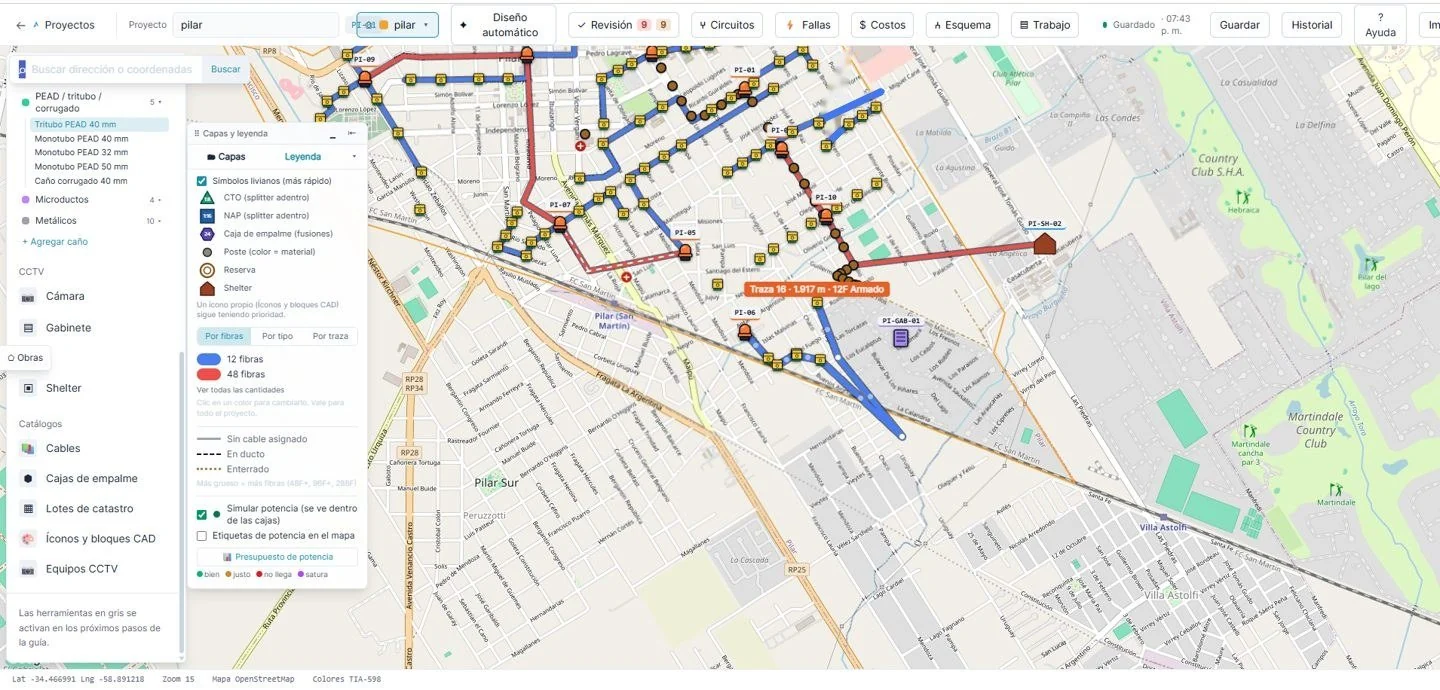
| Plans in Excel and in someone’s head | One network, always up to date, on the computer and on the phone |
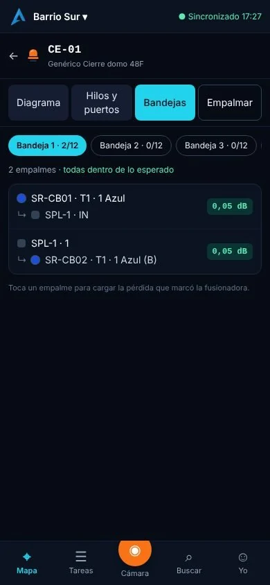
| The technician calls the office to ask which fiber to use | The technician sees inside the box on their phone |
| Sales in areas with no free ports | Instant feasibility check, with the port reserved |
| The customer calls three times asking about the technician | The customer follows the technician with a link |
| Visits nobody bills for | Every visit with its payment link |
| Nobody knows what the project cost | The cost of every project before it starts |
How it works
01 · WHAT YOU DO
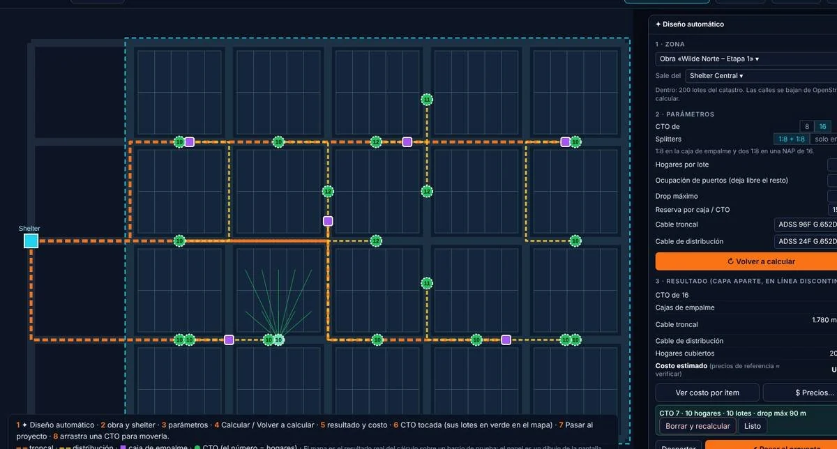
Draw or import your network and the automatic design lays out boxes, splitters and cables along the streets, with the power at every port.
02 · WHAT YOU DO
The crew carries the project on their phone, with no signal: they see inside every box, mark what’s built and take geotagged photos.
03 · WHAT YOU DO
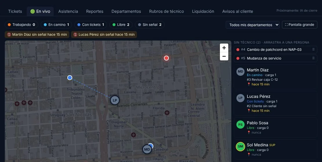
Tickets by department, live dispatch and a link so the customer can follow the technician.
04 · WHAT YOU DO
One price list for everyone and a payment link straight from the ticket.
Sees the whole business at a glance: how many customers fit, build costs, sales and collections.
Designs fiber by fiber, with the power at every port and plans for AutoCAD.
Carry the project on their phone, with no signal, with every box shown from the inside.
Confirms feasibility instantly and reserves the customer’s port.
Works with tickets by department and sends the customer a link to follow the technician.
Import
Export
Coordinates: WGS84, UTM or POSGAR 2007 (Gauss-Krüger), whichever your municipality uses.
| Criteria | Spreadsheets + Google Earth | Acrux Maps |
|---|---|---|
| Network up to date for everyone | Everyone has their own copy | One network, on the computer and on the phone |
| Field work with no signal | No | Field app that works offline |
| Power per port | Calculated by hand | Calculated at every port |
| Billing for visits | Separately | Payment link from the ticket |
| Price | Free, but with hours lost | From ARS 45,000 per month + VAT |
Unlike imported systems: support from Argentina, pricing in pesos, and built for ISPs in the region.
Plug in your numbers: visits that go unbilled plus the hours spent hunting for information.
Plans
Monthly price plus VAT; pay with Mercado Pago or bank transfer and change plans whenever you like.
ARS 45,000per month + VAT
ARS 120,000per month + VAT
Custom
No. Acrux Maps runs in the browser; the crew uses the field app on their phone.
Yes. The app stores the project on the phone; whatever the technician enters syncs when the signal comes back, and the office approves it.
Yes: Google Earth KML and KMZ, Shapefile, DXF, GeoPackage, GeoJSON and GML.
Only your company. Not even the Acrux Maps team can see them.
No. You choose a plan based on users and kilometers of fiber, and change it whenever you like.
Create your account and get 14 days with everything enabled, no card needed. If it works for you, choose a plan and pick up where you left off.
14 days with everything enabled. If it’s not for you, you pay nothing.